Continued from ABC Trek
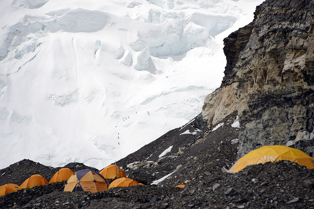
From Mt. Everest’s Tibet Base Camp to Advanced Base Camp, the journey so far was nothing but hiking. Directly from ABC, however, we could see the North Col looming in front of us. This was when we transitioned from hiking in the valley to actually climbing on Mt. Everest. From ABC, with my zoom lens, I could even make out climbers going up the wall as they headed toward 23,000 feet (7,000 meters).
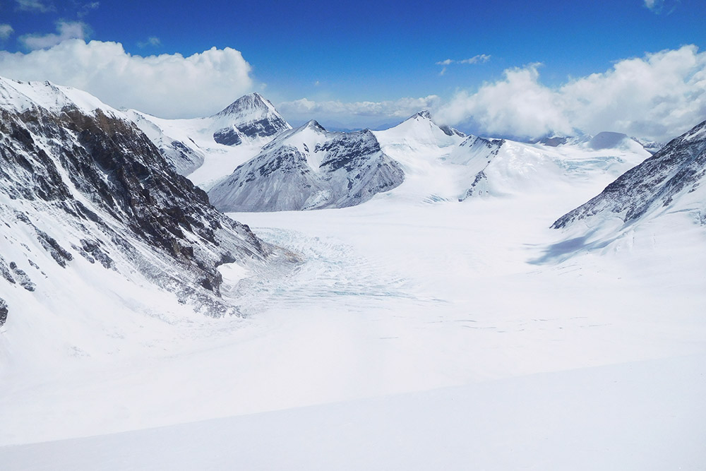
This next photo was taken from the top of the North Col after the climb was finished. I’m posting it now so you can see the flat snowfield you have to cross after leaving ABC to get to the bottom of the North Col. It’s hard to tell in the photo, but you can almost see ABC near the left center of the picture.
From here there is about an hour of hiking through some rocky terrain, then another hour across the snowfield. The bottom of the actual climb up the North Col is around 22,000 feet (6,700 meters).
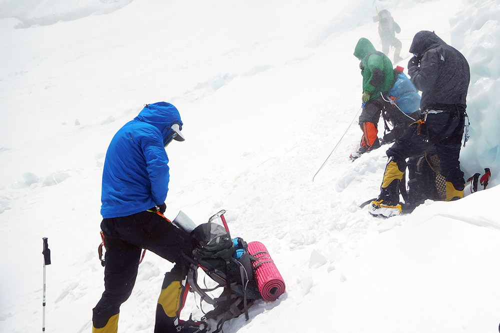
The crampon point is before you cross the snowfield, so by the time we reached the bottom of the North Col we were already geared up. It’s still a good place to stop for a final break, and most people leave their trekking poles behind here.
We went up the North Col multiple times to acclimatize, drop off gear, and of course on the final summit push. Every time there were high winds across the snowfield, which usually dropped off once we actually started climbing the face. Above is my team preparing to start the climb up Mt. Everest for the first time on this expedition.
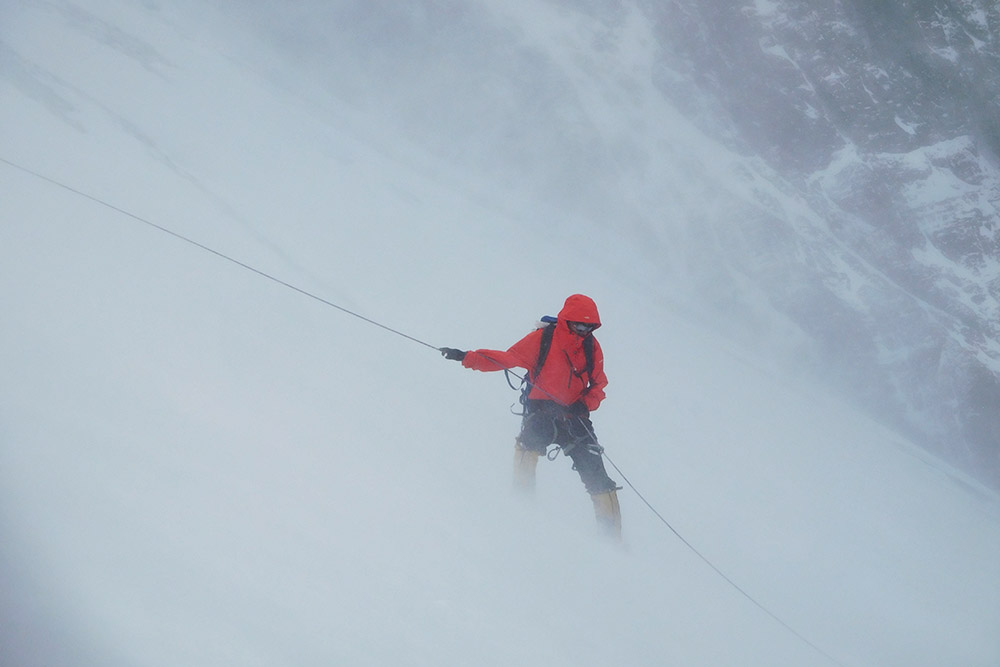
One of the times we went up the North Col we had some serious winds. It wasn’t even snowing outside, but the winds blew so much loose snow around that it almost looked like we were in a snowstorm. Above is a photo of someone descending the North Col while I passed him going up.
Below is a photo of a friend I made on the expedition who was climbing ahead of me. After this steep section was a small flat area where we could take a water break.
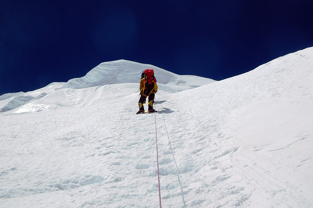
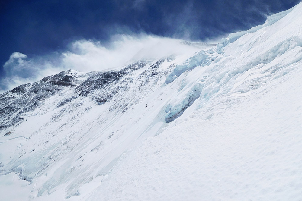
The North Col looks extremely intimidating from a distance. Once you’re actually climbing it, it’s obviously very steep but feels much more doable. I took the photo above halfway up the North Col to show how steep some of the slopes are. It’s a mix of very steep and easier sections and isn’t consistent at all.
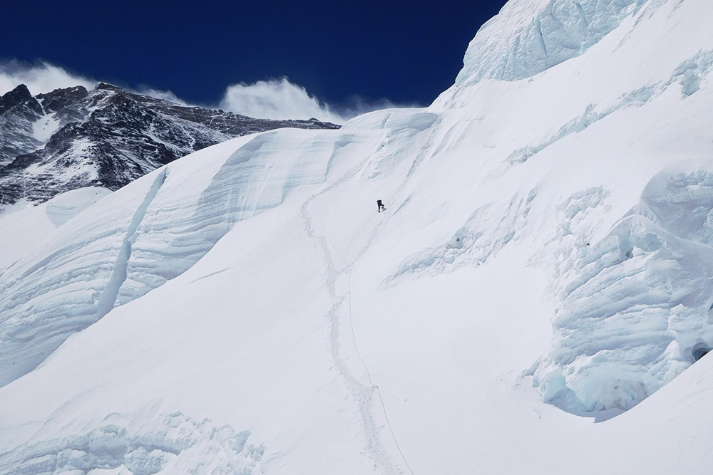
As a matter of fact, I found the very end of the North Col to be the most painful part. Above is a climber just below the final ridge. It’s hard to believe when you’re actually climbing at this point that there are tents just minutes above you at Camp I.
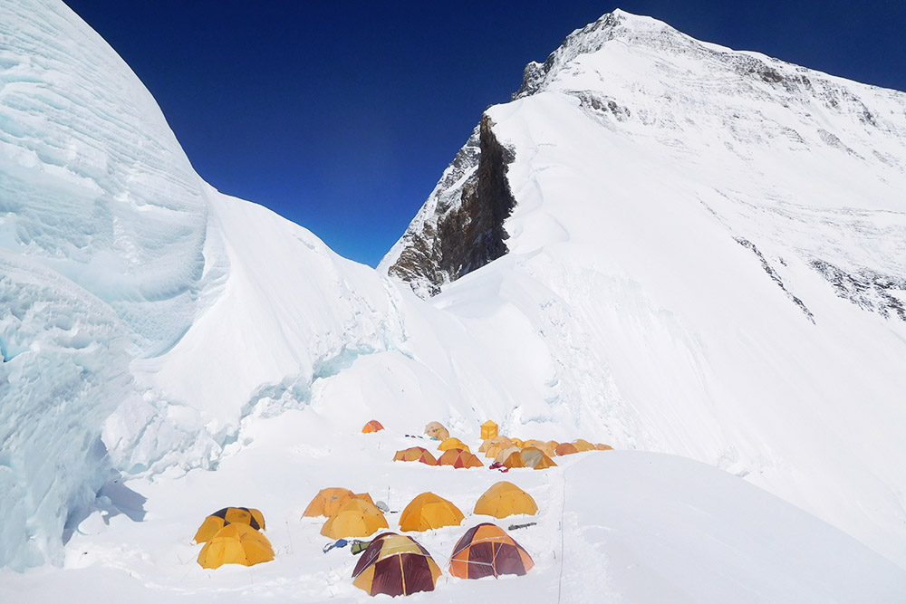
The North Col sits at around 23,000 feet (7,000 meters). The first time I came up here I found it difficult just to walk because of the lack of oxygen. I was horrified to discover that these first tents didn’t belong to my expedition and I had to continue walking along the ridge.
About ten minutes later I arrived at our camp, photographed below. Like the year before, sleeping at this altitude was very difficult. It wasn’t as bad as the previous year, but regardless I hardly got any sleep that night, maybe an hour at most without waking up.
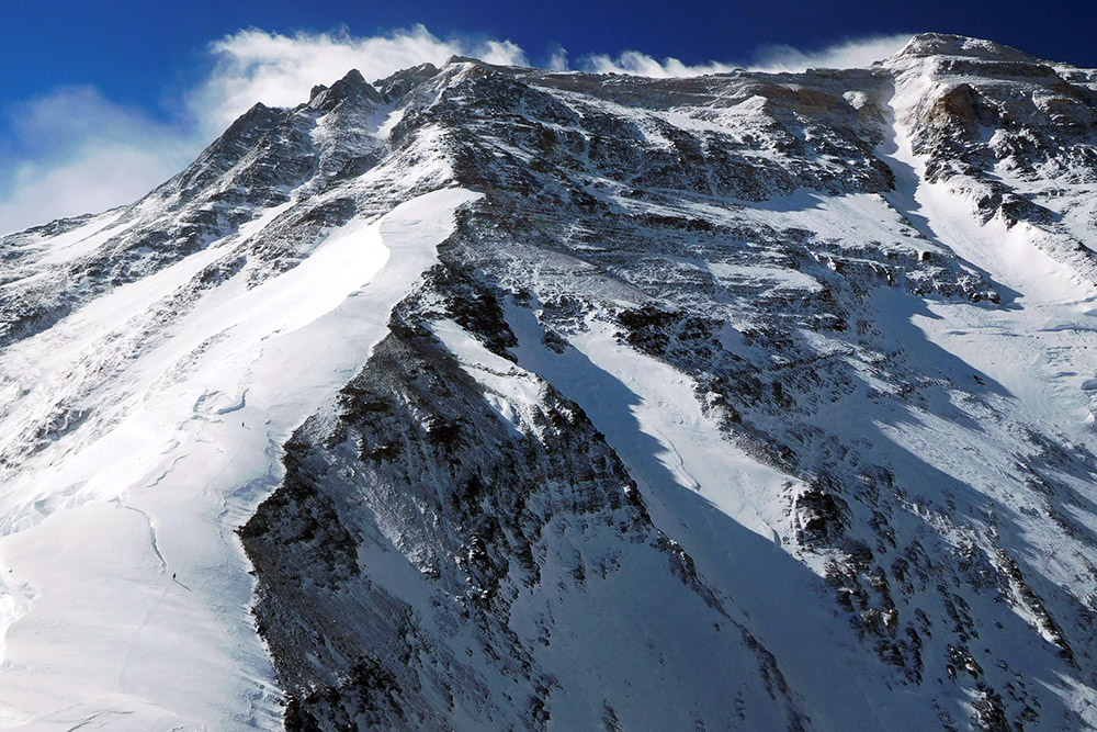
From the North Col you can get a misleading view of almost the entire route toward the summit. The snow slope you see on the left-hand side of the photo is the route up toward Camp II. From Camp II, which can be located around 25,000 feet or higher depending on the expedition, you continue up the rocky North Ridge toward the highest camp below the summit ridge.
Our Camp II was ultimately established unusually high, at around 25,500 feet (7,850 meters), while Camp III was around 27,000 feet (8,300 meters). Camp III on this route is one of the highest camps used anywhere in mountaineering.
The view is misleading because it almost appears that once you reach the summit ridge, the route from Camp III to the top of the world is relatively flat. In reality, this is one of the most technical and exposed parts of the entire climb, famous for the First, Second, and Third Steps along the Northeast Ridge.
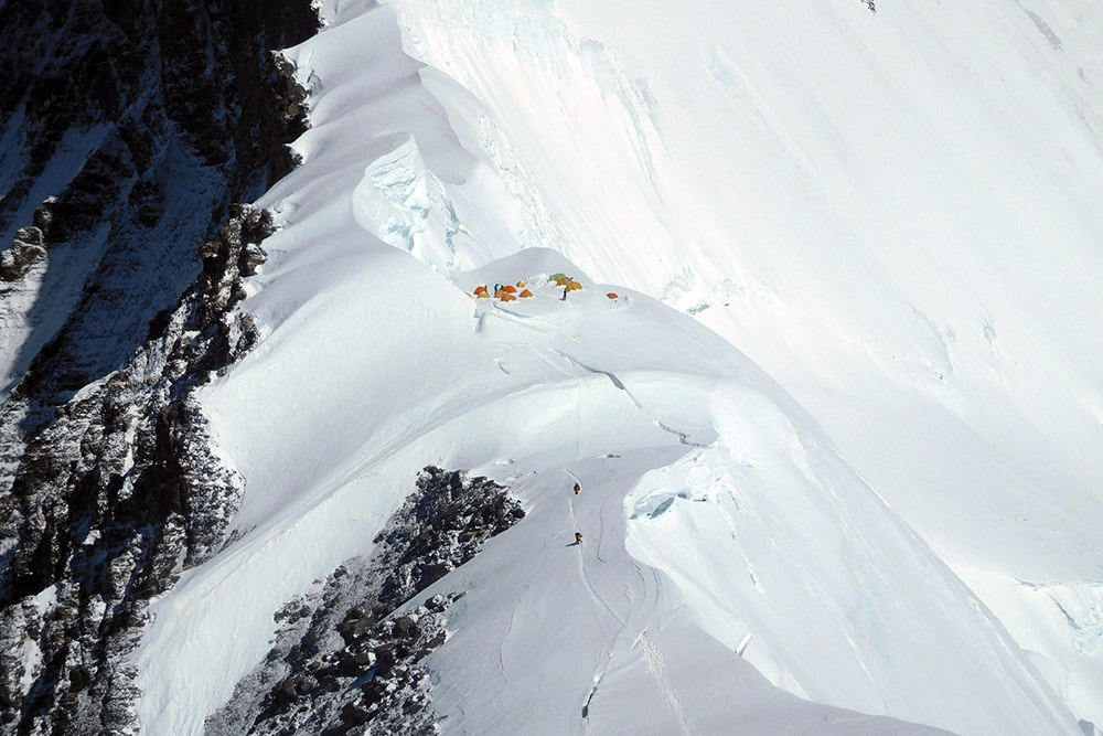
I went up the snow slope twice, once without oxygen to acclimatize and again on the summit push. From the snow slope you can get an excellent view of Camp I on the North Col. While you’re actually in camp, it doesn’t appear half as narrow as it does in the photo above.
I met some climbers who had returned to Everest for a second time and told me that the year before Camp I had been even narrower and more exposed.
After we slept at the North Col to acclimatize and returned to Base Camp, it was nearly three weeks before we finally came back for the summit push. We spent another night at the North Col and slept without oxygen before pushing up the North Ridge to Camp II the next day.
The snow slope that you could see in the other photos was absolute torture. After a short time, it seriously looked like we were at the end of it and would finally be entering the rocky sections. Instead, it continued for hours. The snow slope wasn’t technically hard, but it just seemed to never end.
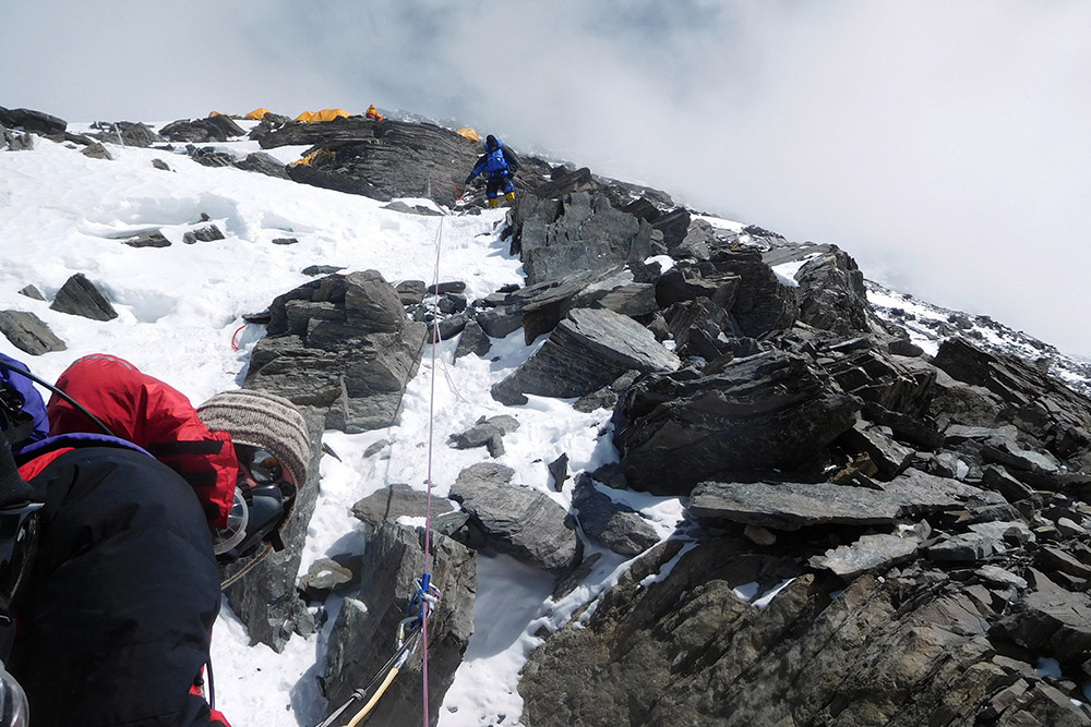
Once we finally left the snow slope, we entered the steep rocky ridge photographed above.
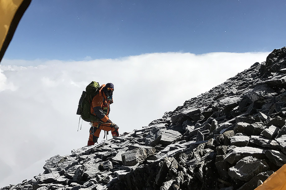
The rocky section of the ridge wasn’t much steeper than the snow slope. Rarely did you have to use your hands to get past anything, but occasionally it helped to stabilize yourself.
Camp II can be established at different locations along the ridge above the snow slope. Ours was just about as high as you could reasonably have it and was located at around 25,500 feet (7,850 meters). We were just below the traditional 8,000-meter boundary of the death zone and nearly as high as the summit camp on the Nepal side.
Once here, we got a report that the weather the next day wouldn’t be good. We decided to stay in Camp II for a second night and wait. The photo above was taken from my tent as a climber headed up the ridge past me.
On the second day, my friend and climbing partner who I had climbed Carstensz Pyramid with decided to head down the mountain. He wasn’t feeling well and no longer thought it was a good idea to continue to higher altitude.
The second night I spent in my tent alone, and I woke up to a violent windstorm. The video above should speak for itself. I woke up around 5:30 A.M. to such violent winds that I thought my tent would be blown off the mountain. When I first opened my eyes, the tent was nearly on my chest and I thought I was dreaming.
I had to escape by sliding out the door, which was completely on the ground, and grabbing what I could. I had left nearly half my gear inside the tent and ran into my friends’ tent. Soon after, their tent was too beaten up and we had to abandon that one too.
The winds never died down, and around 3 P.M. our expedition leader said we had to abandon the summit attempt and head down to the North Col. We had lost lots of our gear, our tents were destroyed, and none of us had eaten or drunk much that day.
I couldn’t believe I had failed to climb Everest two years in a row.
We all headed down the North Ridge in the violent weather, and one of our friends who never showed up later had to be rescued. He had severe frostbite, had lost a crampon, and was disoriented.
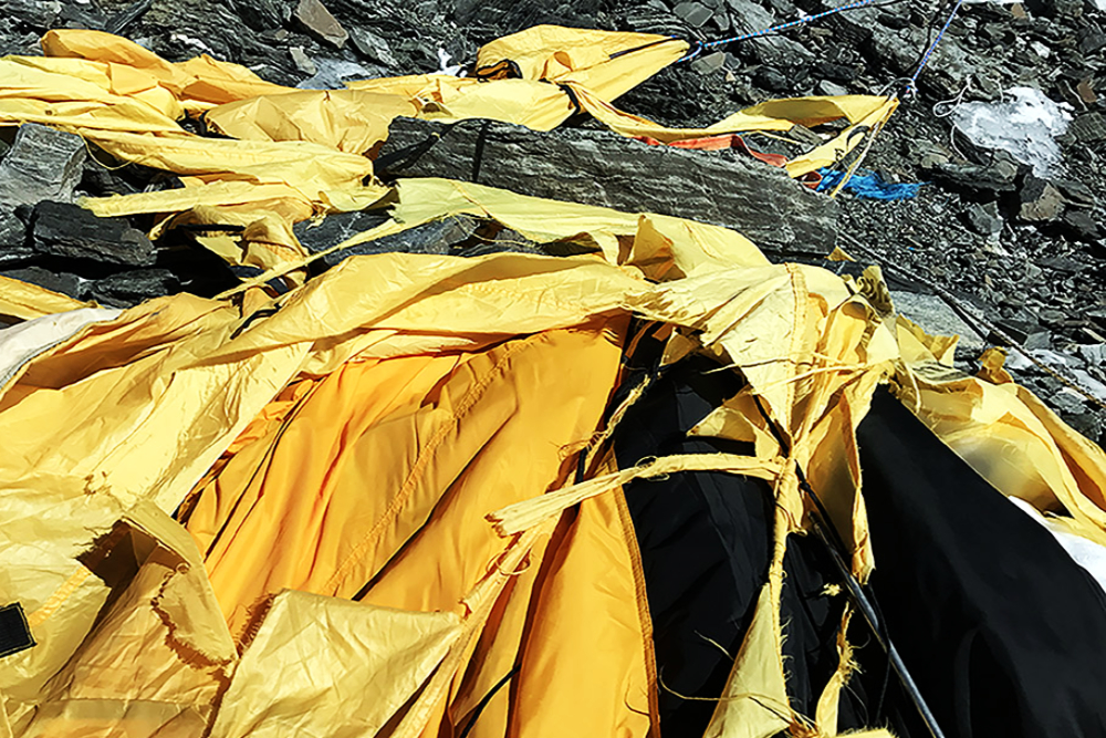
Despite the losses we had suffered, some of us started talking about going back up. There were only six of us left from the original dozen who had begun the expedition from day one.
It seemed suicidal to return up the slope. I had almost no energy left, and I couldn’t imagine going all the way back up the ridge and then proceeding even higher to Camp III and eventually on to the summit.
After a rest day at the North Col, five of us decided to return.
I felt our chances were hopeless. When I left my tent at the North Col, I was so exhausted that I seriously had trouble standing up. I figured I’d hike up the North Ridge for about an hour and then turn around.
Instead, I started breathing supplemental oxygen again, ate as much as I possibly could, and with each step I took higher, the better I felt.
It usually doesn’t work that way!
Returning to Camp II, we were able to see the destruction left behind from the storm. Above is a picture of my tent only two days later.